Commonly known as the Spice Islands, Zanzibar is much more than what meets the eye as it qualifies as a flawless beach destination along with the exotic wildlife, colonial history and an enjoyable climate. And to answer your question, Zanzibar is known as the Spice Islands because it has been producing spices such as cinnamon, cloves, nutmeg, and black pepper for a long time for trading purposes.
Where is Zanzibar located?
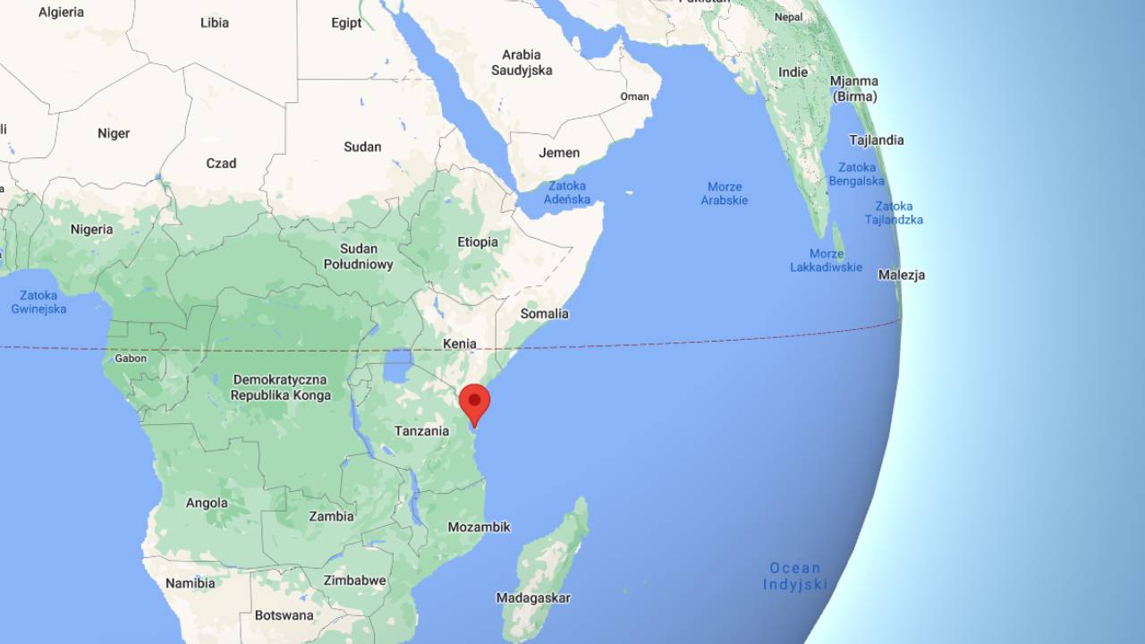
Zanzibar is one of the semi-autonomous islands in the Indian Ocean, (that is an area depending on another region) and it is located off the coast of mainland Tanzania. The Zanzibar archipelago consists of four islands- Unguja Island, Pemba Island, Mafia Island and Latham Island.
How is the Zanzibar Archipelago made?
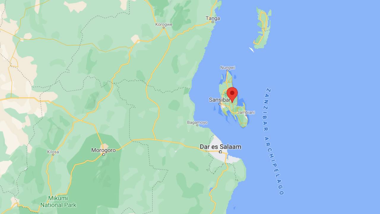
 When you are looking at a map, you will be able to see that the Unguja island is in the middle of this island chain along with Latham Island, Pemba Island is near the border between Kenya and Tanzania while the Mafia Island is a little below at the south of the mainland. Out of these four main islands, Unguja Island and Pemba Island are considered the largest.
These islands are separated from the mainland by the three channels of the same names- Zanzibar Channel, Pemba Channel and Mafia Channel.
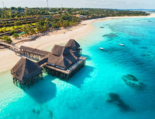
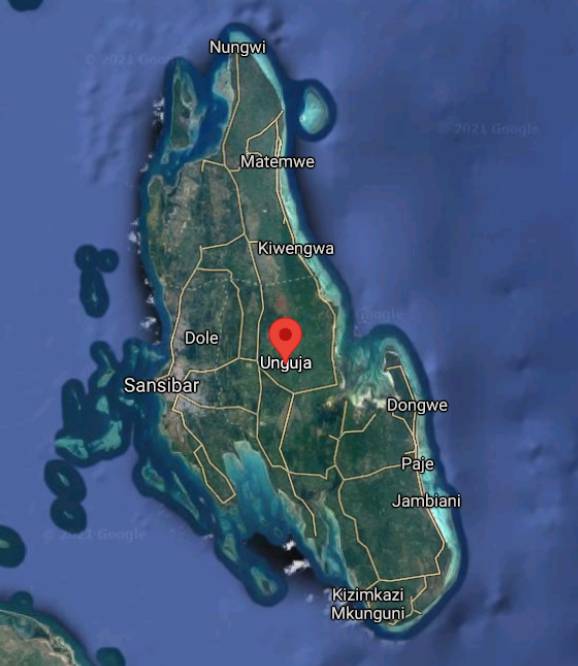
- Unguja Island: This island is unofficially known as Zanzibar and it is largely populated when compared to the other islands. There are some other tiny islets as well; altogether consisting of three areas as Northern Zanzibar, Southern Zanzibar and Western Zanzibar. The Unguja Island covers an area of 1464 km2 with a length of 85 kilometers and a width of 39 kilometers. You can also see many colorful coral reefs off the coast. The capital of Zanzibar which is known as the ‘Zanzibar city’ is located on the Unguja island.
- Pemba Island: This island is also known as the ‘Green Island’ because of the distinct green appearance from the rest of the islands in Zanzibar. It is also the second-largest island and covers an area of 985 km2 with a length of 67 kilometers and a width of 23 kilometers. Some islands are surrounding it too, including Mtangani Island and Panza Island.
- Mafia Island: This island is unofficially known as Chole Shamba, and it is the third-largest island covering an area of 435 km2 with a length of 49 kilometers and a width of 17 kilometers. However, the Mafia Island belongs to the Pwani Region and not to the
semi-autonomous region of Zanzibar. In here also you can see surrounding islands like the Chole Island and Juani Island. - Latham Island: This island is unofficially known as the Fungu Kizimkazi, and it is famous for colorful coral reefs and as a breeding place for seabirds including the Greater Crested Tern. But it is currently an inhabited island covering an area of 0.03 km2 with a length of 0.3 kilometers and a width of 0.1 kilometers.
What is the climate of Zanzibar?
With the weather of Tanzania being very unpredictable, you can only assume the same about Zanzibar’s climate. But generally, the climate is tropical due to the closeness to the equator and the weather is hot throughout the year.
But there are two rainy seasons; one being heavy rains falling from March to May while the other is with fewer rains falling from November to December. Therefore, the wettest month is April and the driest month is July in Zanzibar.
So, if you want to enjoy the outdoors, most probably by spending a day at the beach the best time to visit will be in July to September when there is minimal rainfall.